
Making our region's data accessible Environmental data at Horizons
Horizons Regional Council operates and maintains an environmental data monitoring network of more than 800 sites across the region, collecting river and rainfall data, air quality data and more.

As a regional council, we are responsible for collecting, storing and analysing environmental data in our region. We manage a network of monitoring sites throughout the Horizons Region which gives us an accurate picture of the state of our environment, how it changes over time, and how it continues to change. We then store and use this data to create models for predicting the future state of the environment, to help us make key decisions, and to report our work back to central government. Data we collect is also available for anyone to use for free.
During weather events such as heavy rain or river flooding, our monitoring network is vital for collecting near real-time data about what’s happening on the ground. This information is key for us to coordinate an emergency response, which we manage as the Manawatū Whanganui Civil Defence Emergency Management Group. We also use this data to help us help you stay informed during an emergency. Find out more about being prepared for emergencies on the MWCDEM website, and follow the Civil Defence Manawatū Whanganui Facebook page for emergency updates.

Our region in data View our environmental data
Find and explore environmental data from more than 800 sites across our region.
Our monitoring network
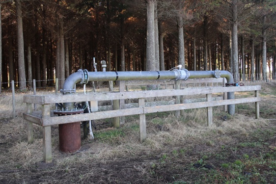
Throughout the Horizons Region, we have monitoring sites in every district collecting a range of data, including air quality; air and water temperature; river levels and flow rate; groundwater levels; turbidity; rainfall levels; soil moisture; and more. We have owned, operated and maintained our own network for more than 25 years, with our Environmental Data team managing more than 800 sites across the region and the data we collect from them.
Data is collected at the site and telemetered (transferred) back to the Horizons’ office via our own digital and radio satellite network. We then store, analyse and use that data for a variety of work, including checking consents such as water takes for compliance, policymaking, environmental reporting, in emergency situations, and more.
|
|
|---|
Recent upgrades
Following Cyclone Gabrielle in 2023, a review of the network clarified how we could improve our monitoring network. Some parts of our region did not have as good coverage as others. The network also relied on external telecommunications infrastructure, such as cell towers, which can become vulnerable during weather events.
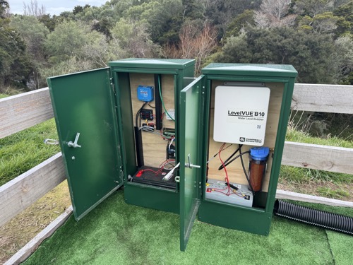
In 2024 and 2025, we upgraded a significant number of our river and rainfall monitoring sites. These upgrades, done completely in-house by Horizons staff, gave sites more methods of data transfer, faster transfer times, and backup power generation – all helping to increase the network’s resilience and reliability in flood events.
All sites now have a minimum of five days’ backup power available, and solar and voltage monitoring. We also increased the automatic data transfer timing (the time it takes data to get from site to office) to every 5 minutes, giving us an even clearer picture of what is happening as it happens.
Along with upgrades to physical infrastructure, we’re also updating the internal software systems we use which bring in, store and process raw data for us to use, which is then put on our Envirodata website.
We were able to complete this work through funding from central government's Cyclone Recovery Flood Resilience Co-investment Fund. You can read more about the funding specifics of this work here.

Manage your property's flood risk River level alert system
To help you manage your property’s river flooding risk, we also run an automated River Alert System you can subscribe to. When you sign up, you’ll indicate which locations and river heights you would like to be notified of. When levels reach your indicated height, the system automatically notifies you via phone call. Please note that because this is an automated service, you can receive alerts at any time – including the middle of the night.
If you don’t need immediate automated alerts but are still interested in river level information, you can check any site at any time on the Environmental Data page, or by calling our Waterline number on 0508 4 FLOOD (0508 435 663).