
Restriction Alert
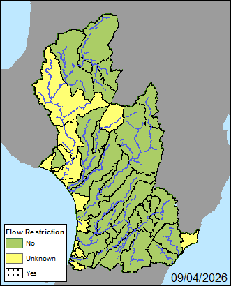
This map displays the water management zones that are currently experiencing some level of flow restriction.
The white zones in the map are those in which someone is currently experiencing a restriction.
The table summarises the status of each of the sites, red is where site are experiencing a restriction.
Please check your resource consent conditions and take appropriate action to ensure that you meet the requirements and comply with your consent.
To find out further details on low flow restrictions please check out our Low Flow Restrictions Summary
Summary table
| Legend (Shading) | Number of sites | Number of consents |
|---|---|---|
| Sites not in restriction | 52 | 156 |
| Sites nearing restriction levels | 2 | 3 |
| Sites in restriction | 2 | 1 |
| Total | 56 | 160 |